Cherry Campground
Open today
As the Forest Service lists it · USDA Forest Service
Campsites
- Standard 14
- Group 4
Activities: Biking, Fishing, Hiking, Horseback riding, Picnicking
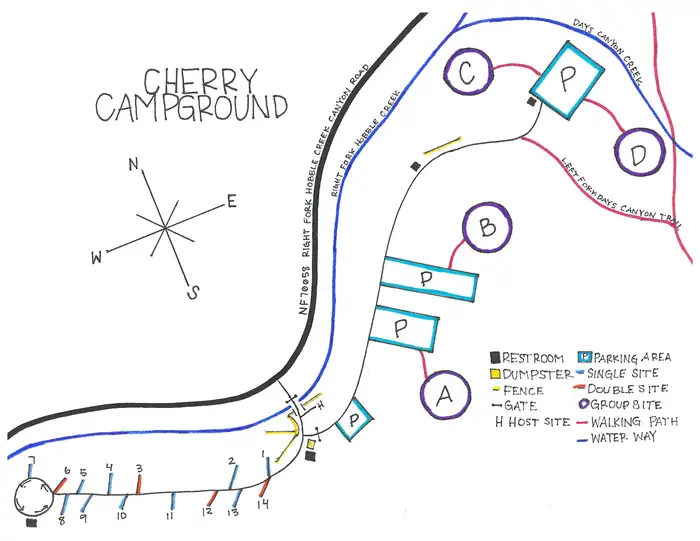
Site by site, from Recreation.gov.
About
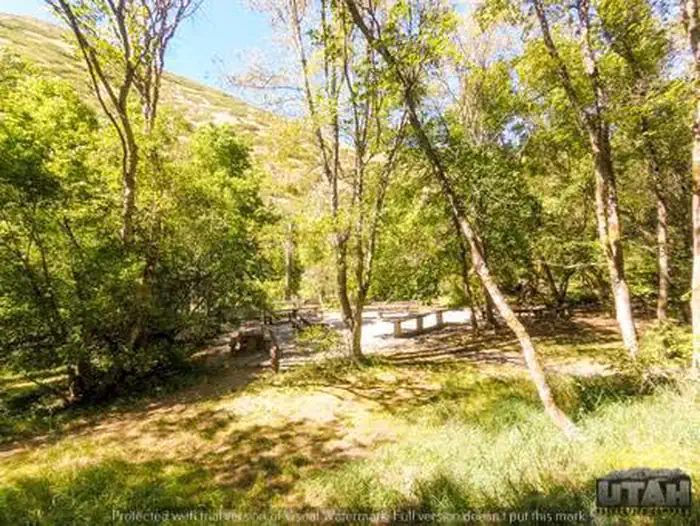
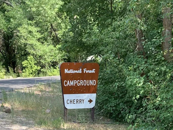
Cherry Campground is located on the banks of pretty Hobble Creek just six miles from Springville, Utah, at an elevation of 5,200 feet. Visitors enjoy exploring local trails.
Facilities
The campground contains four tent-only group sites, three of which accommodate up to 75 people each; the other up to 50 people. Group Sites A and B are accessible. Sites contain picnic and serving tables, a campfire ring with benches, cement site pads and large grassy areas for tents.
Single and double-family sites are available as well, with picnic tables and campfire rings. Vault toilets are provided.
More about Cherry
Natural features
Maple and cottonwood trees forest the area, providing ample shade, beautiful fall color and some privacy between campsites. Hobble Creek runs through the campground.
Recreation
Rainbow trout fishing is popular on Hobble Creek. Several hiking, biking, horseback riding and dirt biking trails are in the area, including Left Fork Days Canyon Trail and Kirkman Hollow Trail. Both trails can be accessed from within the campground.
Nearby attractions
Dry Canyon and Wardsworth Canyon Trails begin near Balsam Campground, 6 miles up-canyon. Hobble Creek Canyon Road offers scenic driving for off-road vehicles above Balsam Campground. Hobble Creek Golf Course is nearby.
From Recreation.gov, updated Aug 11, 2026. Photos as credited.
Nights
model forecastSunset 5:06 PM, sunrise 7:17 AM · Every night at or below freezing
- Tonight77%
- Fri77%35
- Sat
- Sun22%
- Mon22%
- Tue24%
Lows are each next morning's minimum, from the Open-Meteo model at 5,279 ft; rain is the chance that evening or next morning; is the day's strongest gusts, mph, shown from 25 mph. The moon is worked out, not forecast.
Details
- Reservations
- For reservations, information, regulations, and current conditions click here to go to www.recreation.gov
Weather
- Today19Heavy drizzle67%45°36°
- Tomorrow20Light rain0 in37°28°
- Sat21Light snow0 in36°21°
- Sun22Light drizzle39°21°
- Mon23Cloudy22%37°27°
- Tue24Fog39°23°
- Wed25Cloudy24%41°28°
Source: Open-Meteo (CC BY 4.0), model forecast.
Getting there
Phone: SPANISH FORK RANGER DISTRICT 801-798-3571 OR UTAH RECREATION COMPANY 385-273-1100
Directions
From I-15, take Springville exit 260. Continue east through intersection of Main Street and Highway 400 South. At the four-way stop at the end of 400 South, turn right onto Canyon Road. Keep heading east up Canyon Road for about 6 miles. After passing Hobble Creek Golf Course, the road will fork; stay to the right. Cherry Campground is approximately a mile from the golf course, past the junction of Forest Roads 132 and 058.
Nearby
in a straight lineCampgrounds
- WhitingOpen today · 3.7 mi
- BalsamClosed today · 4.5 mi
- DiamondOpen today · 7.1 mi
- Diamond ForkOpen today · 7.1 mi
- Rock CanyonClosed today · 9.2 mi
- HopeClosed today · 12 mi