LOWER BOWNS CAMPGROUND
Open today
As the Forest Service lists it · USDA Forest Service
Campsites
- Standard 4
- Group 1
Activities: Biking, Boating, Fishing, Hiking, Hunting and 1 more
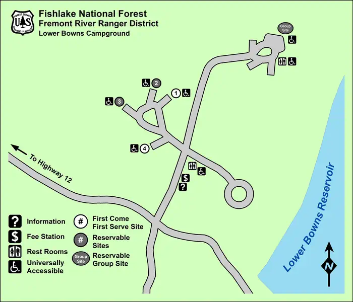
Site by site, from Recreation.gov.
About

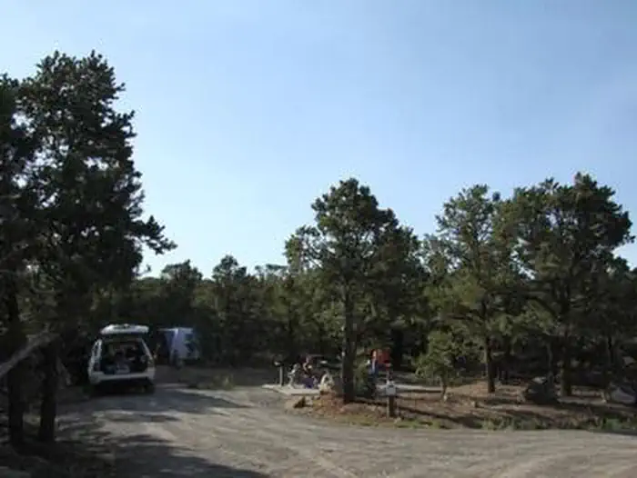
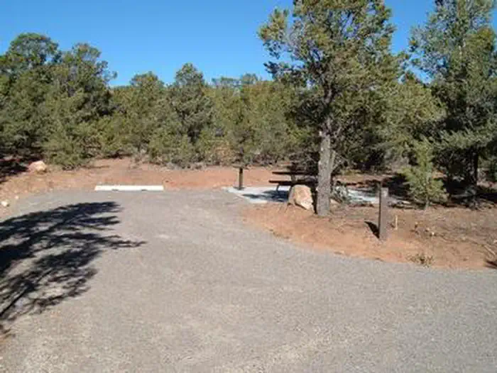
Lower Bowns Campground is located on the east side of Boulder Mountain on the shore of Lower Bowns Reservoir at an elevation of 7,000 feet. Visitors enjoy boating, fishing and exploring local trails.
Facilities
This campground contains three accessible sites: one group site can accommodate up to 50 people, and two single sites can each accommodate up to 10 people.
Vault toilets are provided, and roads and parking spurs throughout the site are gravel.
More about LOWER BOWNS
Natural features
The campground is sparsely forested with pinyon pines and juniper, which offer only limited shade. Boulder Mountain lies to the west of the site, and Capitol Reef National Park's Waterpocket Fold and the Henry Mountains lie to the east.
Recreation
Popular activities in the area include hiking, biking, hunting and riding the Rosebud ATV Trail. Lower Bowns Reservoir offers boating, canoeing and fishing for rainbow, brook and cutthroat trout.
Nearby attractions
Capitol Reef National Park is just 45 minutes from the campground. This unique park offers excellent hiking trails, historic sites and breathtaking scenery.
Sightseeing along Utah Highway 12, a National Scenic Byway, is very popular. Travelers visit from every corner of the world to gaze upon stunning red rock canyons and desert landscapes.
From Recreation.gov, updated Feb 25, 2026. Photos as credited.
Nights
model forecastSunset 5:10 PM, sunrise 7:11 AM · Every night at or below freezing
- Tonight55%45
- Fri55%50
- Sat
- Sun
- Mon
- Tue
Lows are each next morning's minimum, from the Open-Meteo model at 7,444 ft; rain is the chance that evening or next morning; is the day's strongest gusts, mph, shown from 25 mph. The moon is worked out, not forecast.
Details
- Season
- April to Until the snow closes the road
- Reservations
- Single campsites two and three require reservations, as does the group site. Reservations can be made on-line at the Lower Bowns campground on rec.gov website or by telephone: 1-877-444-6777; Tdd 1-877-833-6777
- Fees
- Please Note: All campgrounds on the Fishlake National Forest are managed by High Country Recreation under the terms and conditions of a concession permit that was issued to them by the Forest Service …
- Rules
- Camping is limited to 16 consecutive days. Pets are required to be on a leash. Quiet hours are from 10:00 pm to 6:00 am Mountain Time. OHVs are allowed in the campground for ingress and egress only, they are not allow to be operated for any other reason within the boundary of the campground
Weather
- Today19Snow31%41°30°
- Tomorrow20Heavy snow1 in37°25°
- Sat21Cloudy36°23°
- Sun22Cloudy39°28°
- Mon23Snow showers0 in36°27°
- Tue24Cloudy37°27°
- Wed25Light drizzle37°28°
Source: Open-Meteo (CC BY 4.0), model forecast.
Getting there
Directions
From Torrey, Utah, take Highway 24 approximately one mile east to the junction with Highway 12. Turn right and travel 16 miles to Forest Road 186. Take FR 186 5 miles to the campground.
Nearby
in a straight lineCampgrounds
- UPPER PLEASANT CREEKClosed today · 3.3 mi
- OAK CREEKClosed today · 3.7 mi
- SINGLETREEClosed today · 4.9 mi
- Group CampsiteOpen today · 12 mi
- Backcountry CampingOpen today · 12 mi
- FruitaOpen today · 12 mi