Buttermilk
None of 5 lifts running right now
Most on Sat 28 and Sun 29, 3 in · Rain at the base Sat 28 and Sun 29 · Upper mountain
- Today22Cloudy41°14°
- Tomorrow23Snow1 in39°27°Snow to the base
- Tue24Snow28% chance37°18°
Daily forecast · 7 more days
- Wed25Cloudy46°21°
- Thu26Cloudy45°27°
- Fri27Cloudy46°28°
- Sat28Heavy drizzle3 in41°32°Rain at the base, snow above 8,200 ft
- Sun29Light rain3 in41°30°Rain at the base, snow above 8,100 ft, then above 9,200 ft
- Mon30Light snow2 in37°27°Snow to the base
- Tue1Cloudy34% chance41°19°
Forecast: Open-Meteo (CC BY 4.0)
Checked at 1:16 PM · 1:16 PM local time · from aspensnowmass.com
Buttermilk webcams
Map
Maps
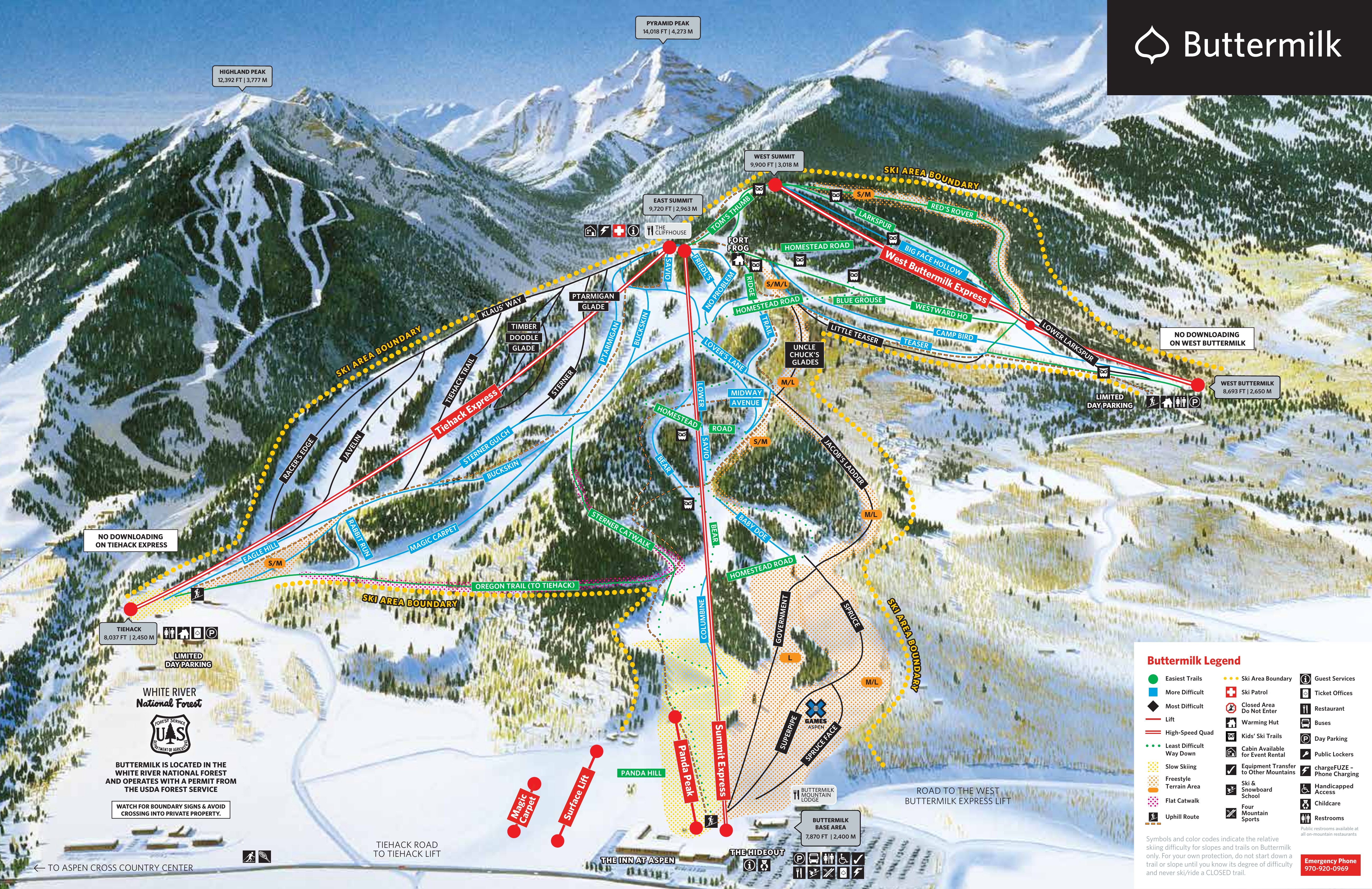
Vertical drop: 2,001 ft verticalBase 7,881 · Top 9,882 ft#220 of 318 on status.live
Getting there
- CO-82closed · seasonal closure (CO 82, between Benedict Drive (Aspen) and Carlton Tunnel Road (Independence Pass))
Road and nearby webcams4
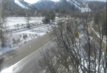
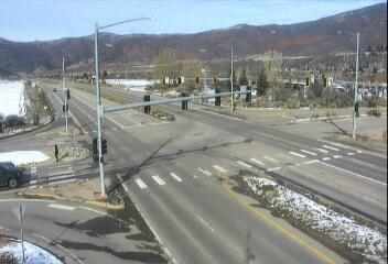
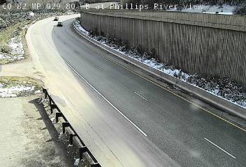
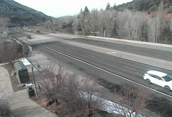
Source: CDOT / COtrip, checked 1:01 PM
Buttermilk lift status
0 of 5 openAll 5 lifts closedShow
- Magic CarpetClosed
- Panda PeakClosed
- Summit ExpressClosed
- Tiehack ExpressClosed
- West Buttermilk ExpressClosed
Source: aspensnowmass.com, the resort's own lift board, checked every few minutes.
Runs
0 of 48 openAll 48 runs closedShow
- Blue GrouseGreenClosed
- Homestead RoadGreenClosed
- LarkspurGreenGroomedClosed
- Oregon TrailGreenClosed
- Panda HillGreenGroomedClosed
- Ridge TrailGreenClosed
- Spruce (Upper)GreenClosed
- Sterner CatwalkGreenClosed
- Tom's ThumbGreenGroomedClosed
- Westward HoGreenGroomedClosed
- Baby DoeBlueGroomedClosed
- BearBlueClosed
- Big Face HollowBlueGroomedClosed
- BuckskinBlueClosed
- Camp BirdBlueClosed
- ColumbineBlueGroomedClosed
- Eagle HillBlueClosed
- Friedl'sBlueClosed
- Lover's LaneBlueGroomedClosed
- Lower SavioBlueClosed
- Magic CarpetBlueClosed
- Midway AvenueBlueGroomedClosed
- No ProblemBlueClosed
- Northeast PassageBlueClosed
- PtarmiganBlueClosed
- Rabbit RunBlueClosed
- Savio (Upper)BlueGroomedClosed
- Sterner GulchBlueClosed
- TeaserBlueClosed
- JavelinBlackClosed
- Klaus' WayBlackClosed
- Little TeaserBlackClosed
- Lower LarkspurBlackClosed
- Racer's EdgeBlackClosed
- SternerBlackClosed
- Tiehack TrailBlackClosed
- Timberdoodle GladBlackClosed
- Alex's Alley (formerly Jacob's ladder)Closed
- Family CrossClosed
- GovernmentClosed
- Mini PipeGroomedClosed
- Panda ParkClosed
- Red's RoverClosed
- Spruce FaceClosed
- Super PipeClosed
- Teaser ParkClosed
- Tiehack Snow CrossClosed
- Uncle Chucks GladesClosed
Same source and update time as the lifts above. Grooming as reported by the resort.
About Buttermilk
History, runs and liftsShow
About
Buttermilk Ski Area is a ski hill and an unincorporated community surrounding it in Pitkin County, Colorado. Located about halfway between the cities of Aspen and Snowmass Village, it is frequently considered the easiest skiing mountain in the area.
More about Buttermilk
Buttermilk has also been the host to the ESPN Winter X Games multiple times. It contains three ski areas: Tiehack (difficult), Main Buttermilk (regular), and West Buttermilk (easy). Art Pfister developed Buttermilk Mountain ski area in 1958.
Buttermilk is anchored by three high speed quads. The Summit Express services trails in the Main Buttermilk section of the mountain. The West Buttermilk Express, built in 2004, services beginner terrain on the west face of the mountain. The Tiehack Express, built in 2011, services advanced and intermediate terrain on the west face of Buttermilk Mountain. Buttermilk is known as one of the best beginner mountains in North America, to learn ski or snowboard. Its base includes The Hideout — an integrated play-and-learning area for children in ski school ages 2 ½ to 6 years old.
In February 2014, Nancy Pfister was found brutally murdered in a walk-in closet of her home in Buttermilk. The case made headlines across the country, and has been featured on Dateline and Snapped.
From Wikipedia: Buttermilk (ski area), CC BY-SA 4.0.
Ski area
- Green 8.6 mi
- Blue 9.2 mi
- Black 7.1 mi
Counted from the runs and lifts mapped in OpenStreetMap, by OpenSkiMap; © OpenStreetMap contributors. Resorts count their own way (trails, acres), so their figures can differ.
Nearby resorts
Ask Claude or ChatGPT "Is Buttermilk open today?" with status.live connected. How to connect