Thanksgiving storm brings snow then rain to bases
Generated automatically by status.live from weather models and the National Weather Service, and written by an AI model from those sources. Not reviewed by a meteorologist.
At a glance
Snow above about 3,800 ft when it starts Thu morning, down to about 3,500 ft by Thu 3 pm. Heaviest Thu morning.
- SchweitzerSnow up top22 inat 6,424 ftModels, top7–22 inAt the base7 inat 3,999 ftSnow, then rain from about Thu 10 pmRain until about Tue 8 pm, then snow
- Mt SpokaneSnow up top20 inat 5,860 ftModels, top6–20 inAt the base4 inat 3,875 ftSnow, then rain from about Thu 10 pmRain Sat to Tue
- 49 Degrees NorthSnow up top15 inat 5,761 ftModels, top6–15 inAt the base4 inat 3,904 ftSnow ThuRain until about Tue 10 pm, then snow
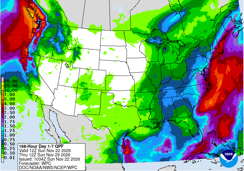
A wetter storm system arrives Wednesday night into Thanksgiving, with snow up top and a rain-snow mix at bases. Skiers should expect rain at the bases from Thursday night into early next week, while upper slopes hold snow.
Rain or snow
Snow starts Thursday morning above about 3,800 feet, lowering to 3,500 feet by 3 pm. Bases turn to rain from about Thursday 10 pm and stay rain until Tuesday evening, then snow returns. Later storm days bring more mountain snow and lowland rain.
Storm totals up top
Confidence is moderate for Thursday and Saturday, with models in fair agreement. Sunday through Tuesday show more spread, with the American model wetter and the German drier, so confidence is lower for those days.
- Schweitzer22 in7 in to 22 in
- Mt Spokane20 in6 in to 20 in
- 49 Degrees North15 in6 in to 15 in
Bar: our forecast, as on each resort's page. Line: lowest to highest of the European, American and German models.
Wind
No gusts of 40 mph up top in the forecast.
- 49 Degrees North20 mphMon 10 am
- Schweitzer14 mphThu 7 pm
- Mt Spokane11 mphThu 5 pm
Strongest gust at each resort’s top lift during the storm, from our forecast, 10 m above the ground. Exposed ridges can gust harder. Many resorts slow or stop exposed lifts from about 40 mph; each sets its own limits. Times: while gusts stay at 40 mph or more; under that, the hour of the strongest gust.
Roads and lifts
The National Weather Service in Spokane says winter travel impacts are possible next week during the busy holiday travel period, with light snow over Cascade passes Tuesday and additional mountain snow Wednesday night into Thanksgiving. Resorts are not yet open for the season.
Next week
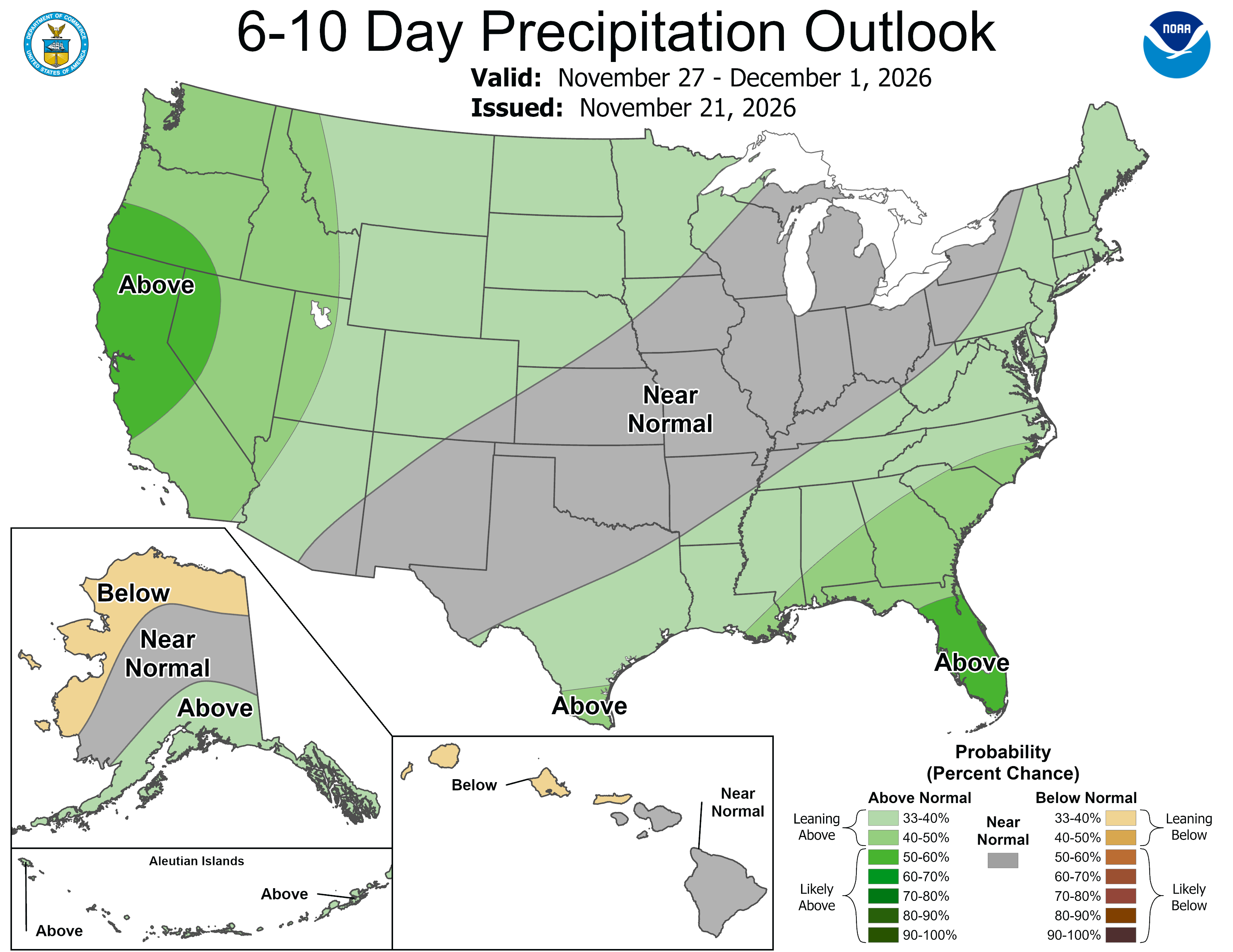
Days 6 to 10, Nov 27 to Dec 1, are low confidence. NOAA's Climate Prediction Center notes models are in fair agreement at best, with the forecast leaning toward the GEFS mean, and uncertainty is increased by differing model handling of the pattern.
 Tap to enlarge
 Tap to enlarge
Other Inland Northwest storms
Sources: model data from Open-Meteo (CC BY 4.0), with rain or snow worked out by status.live from the wet-bulb temperature at each resort's base and top lifts. Discussion: National Weather Service. Maps: NOAA WPC and CPC. Satellite: NOAA GOES-West via NASA GIBS. Lifts and chain controls: status.live, from the resorts and road agencies. Earlier storms.