Inland Northwest: light snow up top, rain at bases
Generated automatically by status.live from weather models and the National Weather Service, and written by an AI model from those sources. Not reviewed by a meteorologist.
How the forecast did
Across 2 measuring stations, the first outlook was about right and the final update 2 in too high at the typical station.
| Estación meteorológica | First outlook | Final update | Measured | Fell as rain |
|---|---|---|---|---|
| Quartz Peak4,700 ft | 1 in | 1 in | 0 in | 100%forecast 82% |
| Schweitzer Basin6,100 ft | 4 in | 6 in | 4 in | 0%forecast 0% |
Measured at NRCS SNOTEL stations near the resorts: new snow is the rise in snow depth; fell as rain is the precipitation that added no snow water. Forecast for each station's spot and elevation.
- Totals down 1 in at a typical resort.
- Snow level when it starts about 600 ft higher.
At a glance
Snow above about 5,700 ft when it starts Sun afternoon, down to about 4,700 ft by Sun 11 pm. Heaviest Sun afternoon.
- 49 Degrees North3 inat 5,761 ft0 inat 3,904 ft2 in to 3 inLluvia en la base
- Schweitzer3 inat 6,424 ft0 inat 3,999 ft3 in to 4 inLluvia en la base
- Mt Spokane2 inat 5,860 ft0 inat 3,875 ft2 in to 3 inLluvia en la base
A weak system brings light rain to resort bases and 2 to 3 inches of snow above about 5,700 feet Sunday afternoon, with the snow level dropping to 4,700 feet by late evening. Skiers will find wet bases and only a few inches of new snow on upper slopes, with no lifts open yet.
Rain or snow
A weak system brings light rain to bases and few inches of snow above 5,700 feet Sunday afternoon, dropping to 4,700 feet late evening. Bases stay rain all day. National Weather Service in Spokane says light rain and snow chances Wednesday through Friday, snow levels near 3,000 feet Thursday.
Storm totals up top
Confidence moderate for Sunday: models agree on 2 to 4 inches up top, bases rain. The American and European models are close, the German model slightly lower.
- 49 Degrees North3 in2 in to 3 in
- Schweitzer3 in3 in to 4 in
- Mt Spokane2 in2 in to 3 in
Bar: our forecast, as on each resort's page. Line: lowest to highest of the European, American and German models.
Roads and lifts
No chain controls or traction laws are listed for the roads to 49 Degrees North, Mt Spokane, or Schweitzer. Resorts are not yet open for the season, with zero lifts running at all three areas.
Next week
For Nov 20-24, confidence is low. NOAA's Climate Prediction Center favors above normal precipitation for the West Coast and Great Basin, with near to below normal temperatures for most of the west, though the northern tier may lean warmer, and models disagree sharply, with the American model showing snow early next week while others stay dry.
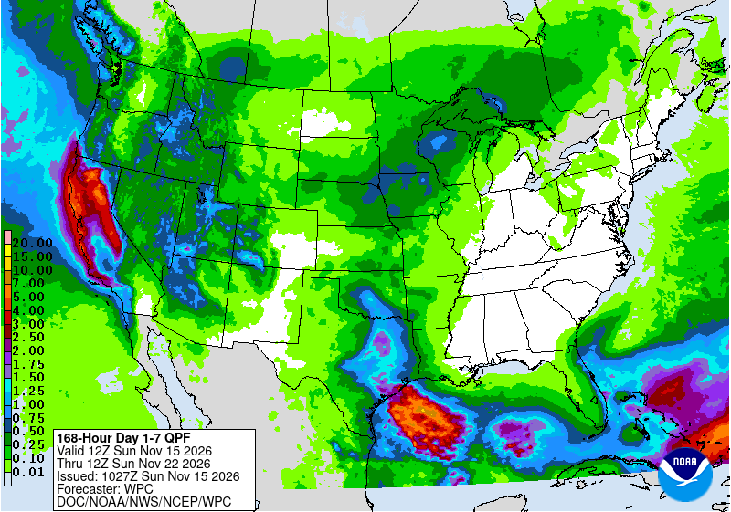 Tap to enlarge
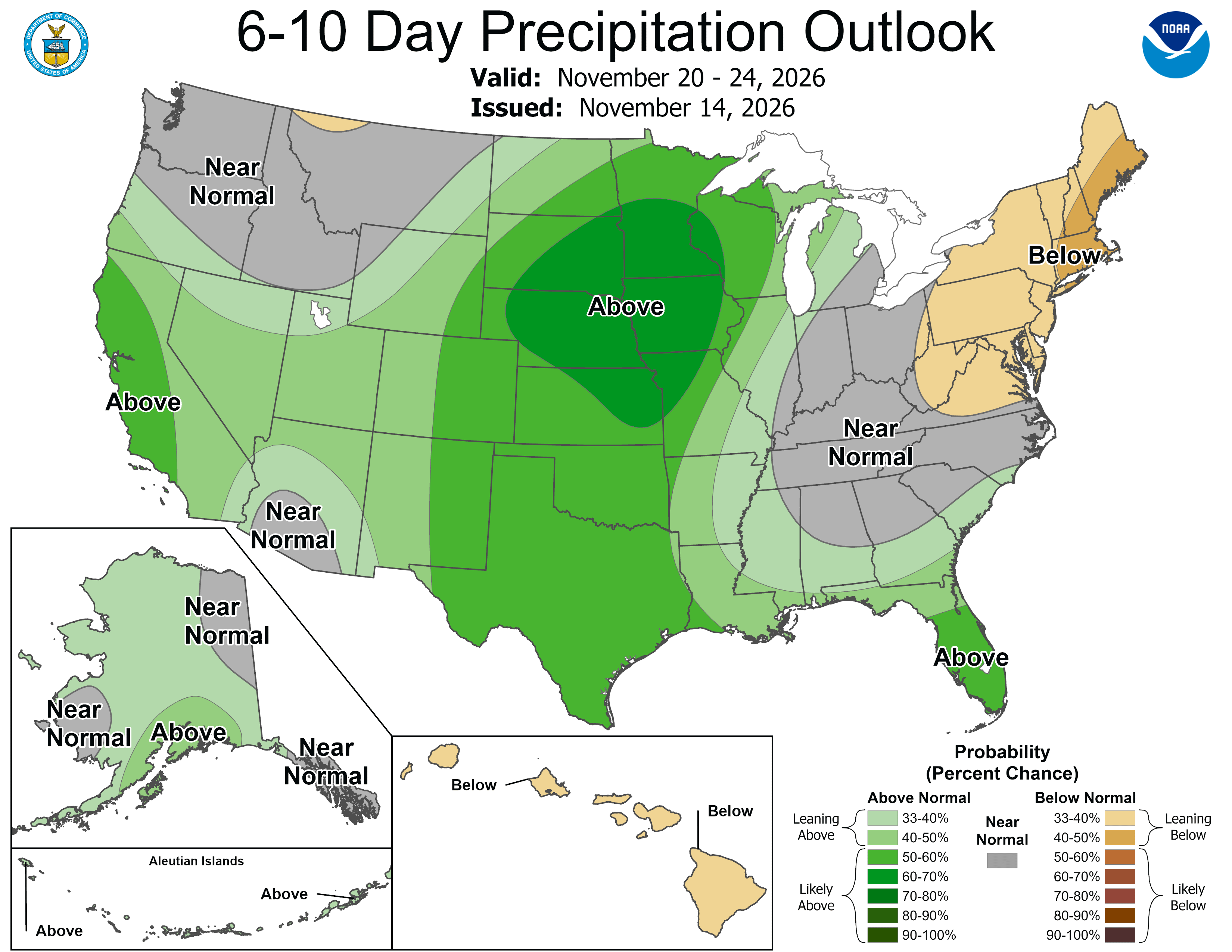 Tap to enlarge
Earlier updates
Sat, Nov 14Totals 2 in to 5 in
Sunday: light snow up top, rain at bases
- Totals up 1 in at a typical resort.
- Snow level when it starts about 300 ft lower.
- Storm days now Sun (were Sat).
Snow above about 5,100 ft when it starts Sun morning, down to about 4,100 ft by Sun 11 pm. Heaviest Sun night.
- Mt Spokane5 inat 5,860 ft0 inat 3,875 ft1 in to 5 inRain until about Sun 11 pm, then snow
- Schweitzer4 inat 6,424 ft0 inat 3,999 ft2 in to 4 inLluvia en la base
- 49 Degrees North2 inat 5,761 ft0 inat 3,904 ft1 in to 2 inSnow, then rain from about Sun 6 am
Fri, Nov 13Totals 1 in to 2 in
Light rain and high mountain snow Sat, then a wetter Sun-Mon
Snow above about 5,400 ft when it starts Sat early morning, down to about 4,600 ft by Sat 4 am. Heaviest Sat early morning.
- Mt Spokane2 inat 5,860 ft0 inat 3,875 ft0 in to 2 inLluvia en la base
- Schweitzer2 inat 6,424 ft0 inat 3,999 ft1 in to 2 inSnow, then rain from about Sat 6 am
- 49 Degrees North1 inat 5,761 ft0 inat 3,904 ft0 in to 1 inLluvia en la base
Sources: model data from Open-Meteo (CC BY 4.0), with rain or snow worked out by status.live from the wet-bulb temperature at each resort's base and top lifts. Discussion: National Weather Service. Maps: NOAA WPC and CPC. Satellite: NOAA GOES-West via NASA GIBS. Lifts and chain controls: status.live, from the resorts and road agencies. Earlier storms.