Heavy Sierra snow Wednesday to Thursday at Mammoth
Generated automatically by status.live from weather models and the National Weather Service, and written by an AI model from those sources. Not reviewed by a meteorologist.
- Totals up 10 in at a typical resort.
- Snow level when it starts about 1,400 ft lower.
At a glance
Snow above about 5,100 ft when it starts Wed morning, rising to about 6,200 ft by Wed 11 pm. Heaviest Wed afternoon.
- Mammoth Mountain30 inat 11,027 ft30 inat 8,058 ft19 in to 30 inSnow to the base
- June Mountain22 inat 10,135 ft22 inat 7,575 ft15 in to 22 inSnow to the base
A stronger, colder storm arrives Wednesday into Thursday with heavy Sierra snow and high winds, heaviest Wednesday afternoon. The bottom line for skiers: snow reaches the base at both Mammoth Mountain and June Mountain, with 30 inches up top at Mammoth and 22 inches at June.
Rain or snow
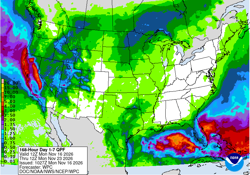
Weak storm brings mountain snow today. Snow starts Wednesday morning above about 5,100 feet, rising to about 6,200 feet Wednesday night, keeping bases all snow. Heaviest snow is Wednesday afternoon. Snow levels fall to about 4,500 to 5,000 feet Thursday. Fast-moving system late Saturday into Sunday.
Storm totals up top
Wednesday is high confidence with models tightly clustered. Thursday is less certain; the American model is highest and the German model is lowest.
- Mammoth Mountain30 in19 in to 30 in
- June Mountain22 in15 in to 22 in
Bar: our forecast, as on each resort's page. Line: lowest to highest of the European, American and German models.
Roads and lifts
US-395, SR-203 and SR-158 are clear now. The National Weather Service in Reno expects winter travel impacts in the Sierra today and heavy snow with high winds Wednesday into Thursday. Resorts are not yet open for the season.
Next week
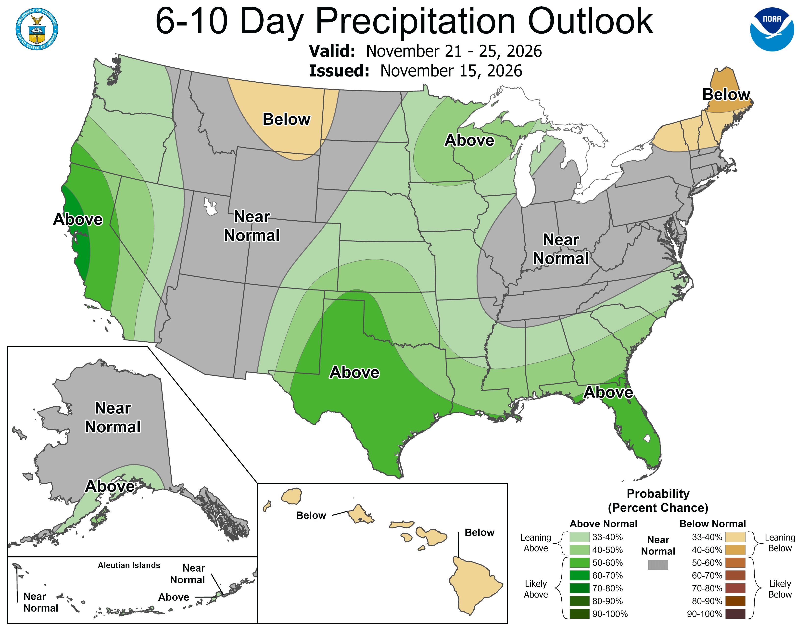
Days 6 to 10, Nov 21 to Nov 25, are low confidence. NOAA's Climate Prediction Center favors above normal precipitation along the West Coast and adjacent Great Basin, and near to above normal temperatures in the West, while the models differ on timing of fast-moving systems.
 Tap to enlarge
 Tap to enlarge
Earlier updates
Sun, Nov 15Totals 13 in to 20 in
Mammoth: 20 in up top Wed-Thu, snow to base
- Totals down 7 in at a typical resort.
- Snow level when it starts about 700 ft higher.
- Storm days now Wed to Thu (were Wed to Fri).
Snow above about 6,500 ft when it starts Wed afternoon, down to about 5,900 ft by Wed 11 pm. Heaviest Wed night.
- Mammoth Mountain20 inat 11,027 ft20 inat 8,058 ft13 in to 20 inSnow to the base
- June Mountain13 inat 10,135 ft13 inat 7,575 ft9 in to 13 inSnow to the base
Sat, Nov 14Totals 20 in to 28 in
Mammoth: snow Sun night, heavier Wed-Thu
Snow above about 5,800 ft when it starts Wed afternoon, staying near that through Wed 11 pm. Heaviest Wed night.
- Mammoth Mountain28 inat 11,027 ft28 inat 8,058 ft9 in to 28 inSnow to the base
- June Mountain20 inat 10,135 ft20 inat 7,575 ft9 in to 20 inSnow to the base
Other Mammoth storms
Sources: model data from Open-Meteo (CC BY 4.0), with rain or snow worked out by status.live from the wet-bulb temperature at each resort's base and top lifts. Discussion: National Weather Service. Maps: NOAA WPC and CPC. Satellite: NOAA GOES-West via NASA GIBS. Lifts and chain controls: status.live, from the resorts and road agencies. Earlier storms.