Wednesday snow for Oregon Cascades, bases mostly snow
Generated automatically by status.live from weather models and the National Weather Service, and written by an AI model from those sources. Not reviewed by a meteorologist.
At a glance
Snow above about 3,100 ft when it starts Wed morning, staying near that through Wed 6 pm. Heaviest Wed afternoon.
- Hoodoo6 inat 5,669 ft6 inat 4,682 ft2 in to 6 inRain until about Wed 3 pm, then snow
- Mount Hood4 inat 7,306 ft4 inat 4,528 ft2 in to 4 inSnow to the base
- Mount Bachelor4 inat 8,944 ft4 inat 5,702 ft3 in to 4 inSnow to the base
- Timberline Lodge2 inat 8,494 ft2 inat 3,983 ft2 in to 4 inSnow to the base
A system brings snow to the Oregon Cascades on Wednesday, with the heaviest snow Wednesday afternoon and snow levels near 3,100 feet. Most resort bases see snow from the start, but Hoodoo's base flips from rain to snow around 3 pm, and no lifts are open yet.
Rain or snow
Snow starts Wednesday morning above 3,100 feet and stays near that level through 6 pm. Most bases turn to snow; one lower base flips from rain to snow around 3 pm. Dry weather returns Thursday and Friday, with precipitation chances increasing by Sunday, per the National Weather Service in Portland.
Storm totals up top
Confidence is moderate for Wednesday snow. Models agree on track but disagree on amounts, with higher pass-level snow chances south of Mount Hood, the National Weather Service in Portland says.
- Hoodoo6 in2 in to 6 in
- Mount Hood4 in2 in to 4 in
- Mount Bachelor4 in3 in to 4 in
- Timberline Lodge2 in2 in to 4 in
Bar: our forecast, as on each resort's page. Line: lowest to highest of the European, American and German models.
Roads and lifts
No chain controls or traction laws are listed now. The National Weather Service in Portland says winter-like driving conditions are possible across Cascade passes Wednesday. Resorts are not yet open for the season.
Next week
For Nov 21-25, confidence is low. NOAA's Climate Prediction Center favors above normal precipitation along the West Coast and near to above normal temperatures for the West, but models disagree on the timing of any weekend system.
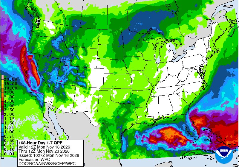 Tap to enlarge
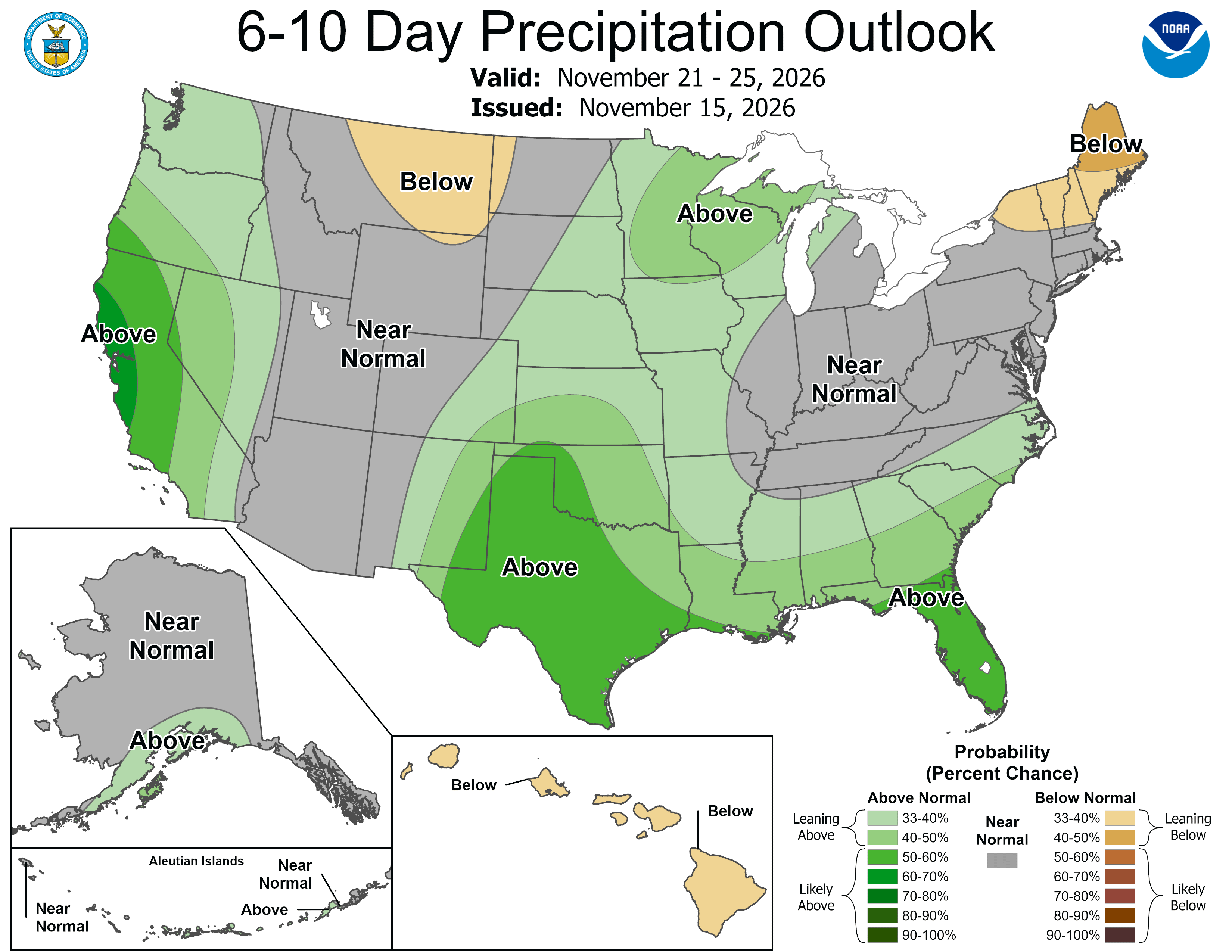 Tap to enlarge
Other Oregon storms
Sources: model data from Open-Meteo (CC BY 4.0), with rain or snow worked out by status.live from the wet-bulb temperature at each resort's base and top lifts. Discussion: National Weather Service. Maps: NOAA WPC and CPC. Satellite: NOAA GOES-West via NASA GIBS. Lifts and chain controls: status.live, from the resorts and road agencies. Earlier storms.