Snow Tuesday, colder Thursday-Friday for Utah resorts
Generated automatically by status.live from weather models and the National Weather Service, and written by an AI model from those sources. Not reviewed by a meteorologist.
- Totals up 11 in at a typical resort.
- Snow level when it starts about 400 ft lower.
- Storm days now Tue to Fri (were Tue).
At a glance
Snow above about 8,000 ft when it starts Tue early morning, down to about 4,600 ft by Tue 11 pm. Heaviest Tue morning.
- Alta18 inat 10,554 ft18 inat 8,537 ft10 in to 21 inSnow to the base Tue; snow to the base Thu to Fri
- Snowbird18 inat 10,958 ft14 inat 7,759 ft10 in to 21 inRain until about Tue 2 pm, then snow; snow to the base Thu to Fri
- Brighton17 inat 10,449 ft17 inat 8,747 ft10 in to 21 inSnow to the base Tue; snow to the base Thu to Fri
- Solitude17 inat 10,010 ft15 inat 8,002 ft10 in to 21 inRain until about Tue 11 am, then snow; snow to the base Thu to Fri
- Brian Head15 inat 10,912 ft15 inat 9,606 ft12 in to 15 inSnow to the base Tue; snow to the base Thu to Fri
- Park City14 inat 9,977 ft9 inat 6,729 ft10 in to 15 inRain until about Tue 6 pm, then snow; snow to the base Thu to Fri
- Snowbasin11 inat 9,367 ft9 inat 6,362 ft11 in to 13 inRain until about Tue 4 pm, then snow; snow to the base Thu to Fri
- Deer Valley9 inat 9,554 ft6 inat 6,450 ft9 in to 15 inRain until about Tue 6 pm, then snow; snow to the base Thu to Fri
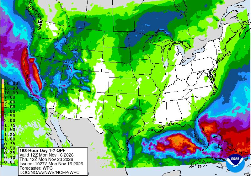
A storm brings mountain snow Tuesday, with snow levels starting near 8000 feet and dropping to about 4600 feet by Tuesday night. A colder, longer storm Thursday into Friday should bring snow to all resort bases, but resorts are not yet open for the season.
Rain or snow
Snow starts Tuesday early morning above about 8000 feet, lowering to about 4600 feet by Tuesday 11 pm. Bases turn to snow between about 11 am and 6 pm Tuesday, with higher bases snow from the start. Thursday and Friday bring snow to all bases.
Storm totals up top
Tuesday confidence is moderate with model spread 10 to 21 inches up top. Thursday models disagree sharply, one shows 8 inches, others 1 to 3. Friday is more consistent.
- Alta18 in10 in to 21 in
- Snowbird18 in10 in to 21 in
- Brighton17 in10 in to 21 in
- Solitude17 in10 in to 21 in
- Brian Head15 in12 in to 15 in
- Park City14 in10 in to 15 in
- Snowbasin11 in11 in to 13 in
- Deer Valley9 in9 in to 15 in
Bar: our forecast, as on each resort's page. Line: lowest to highest of the European, American and German models.
Roads and lifts
No chain controls now. Roads are clear except Brian Head SR-143 has icy spots. The National Weather Service in Salt Lake City cautions high-elevation travel impacts with accumulating snow. Resorts are not yet open for the season.
Next week
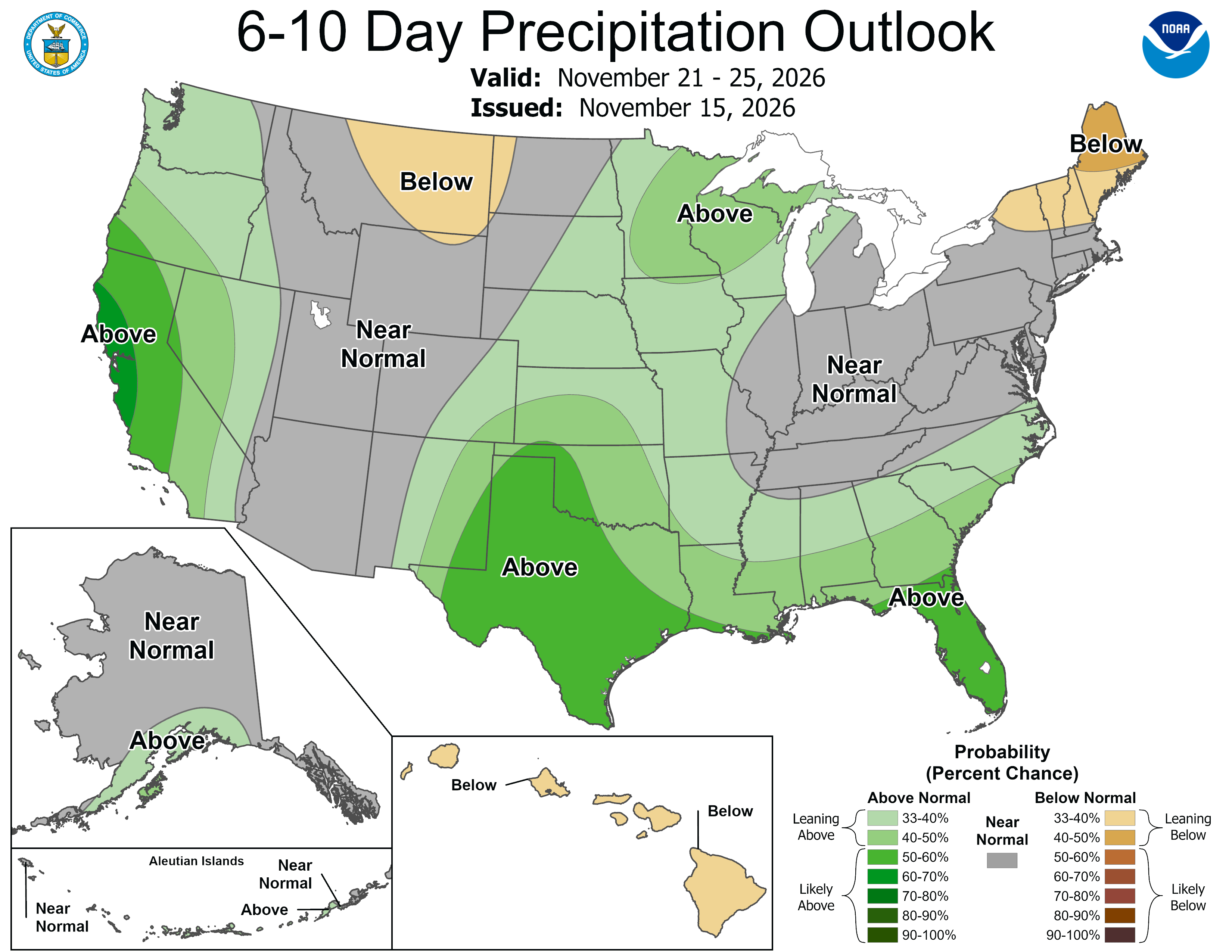
Days 6 to 10, Nov 21 to 25, confidence is low. NOAA's Climate Prediction Center favors above normal precipitation for the Great Basin and near to above normal temperatures for the West, but models disagree on any single storm, with only one model showing meaningful snow late in the period.
 Tap to enlarge
 Tap to enlarge
Earlier updates
Sun, Nov 15Totals 3 in to 10 in
Utah: Tuesday storm, snow above 8400 ft, rain lower bases
Snow above about 8,400 ft when it starts Tue afternoon, down to about 5,700 ft by Tue 11 pm. Heaviest Tue afternoon.
- Snowbasin10 inat 9,367 ft7 inat 6,362 ft4 in to 10 inRain until about Tue 7 pm, then snow
- Brian Head9 inat 10,912 ft9 inat 9,606 ft5 in to 9 inSnow to the base
- Alta6 inat 10,554 ft6 inat 8,537 ft4 in to 7 inRain until about Tue 4 pm, then snow
- Snowbird6 inat 10,958 ft4 inat 7,759 ft4 in to 7 inRain until about Tue 5 pm, then snow
- Brighton5 inat 10,449 ft5 inat 8,747 ft3 in to 7 inSnow to the base
- Solitude5 inat 10,010 ft4 inat 8,002 ft4 in to 7 inRain until about Tue 5 pm, then snow
- Park City4 inat 9,977 ft1 inat 6,729 ft4 in to 5 inRain until about Tue 8 pm, then snow
- Deer Valley3 inat 9,554 ft1 inat 6,450 ft3 in to 5 inRain until about Tue 8 pm, then snow
Other Utah storms
Sources: model data from Open-Meteo (CC BY 4.0), with rain or snow worked out by status.live from the wet-bulb temperature at each resort's base and top lifts. Discussion: National Weather Service. Maps: NOAA WPC and CPC. Satellite: NOAA GOES-West via NASA GIBS. Lifts and chain controls: status.live, from the resorts and road agencies. Earlier storms.