Wyoming: 4 to 8 in Tetons Tue to Wed, bases turn to snow
Generated automatically by status.live from weather models and the National Weather Service, and written by an AI model from those sources. Not reviewed by a meteorologist.
- Totals up 2 in at a typical resort.
- Snow level when it starts about 300 ft higher.
- Storm days now Tue to Wed (were Tue).
At a glance
Snow above about 7,600 ft when it starts Tue afternoon, down to about 7,000 ft by Tue 1 pm. Heaviest Tue morning.
- Jackson Hole5 inat 10,397 ft3 inat 6,319 ft2 in to 5 inRain until about Tue 10 pm, then snow
- Grand Targhee5 inat 9,839 ft4 inat 7,605 ft2 in to 9 inRain until about Tue 1 pm, then snow
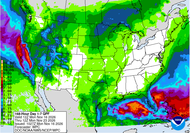
The National Weather Service in Riverton says rain and mountain snow spread across western Wyoming Tuesday morning through Wednesday, with 4 to 8 inches in the Tetons, Gros Ventres, and western Wind River Mountains. Skiers should expect rain at bases Tuesday before snow levels fall to western valleys Tuesday evening, with the heaviest snow before sunrise Wednesday.
Rain or snow
Snow above about 7,600 ft when it starts Tuesday afternoon, down to about 7,000 ft by Tuesday 1 pm. Heaviest Tuesday morning. Bases turn to snow between about Tuesday 1 pm and 10 pm. More snow possible Thursday into Saturday morning.
Storm totals up top
Models disagree: 2 to 9 inches at Grand Targhee, 2 to 5 at Jackson Hole. Confidence moderate Tuesday, lower Wednesday. The European model is wettest, German driest.
- Jackson Hole5 in2 in to 5 in
- Grand Targhee5 in2 in to 9 in
Bar: our forecast, as on each resort's page. Line: lowest to highest of the European, American and German models.
Roads and lifts
No chain controls or traction laws are listed now. The National Weather Service in Riverton says winter travel conditions are likely over mountain passes. Strong wind gusts are likely across central Wyoming. Resorts are not yet open for the season.
Next week
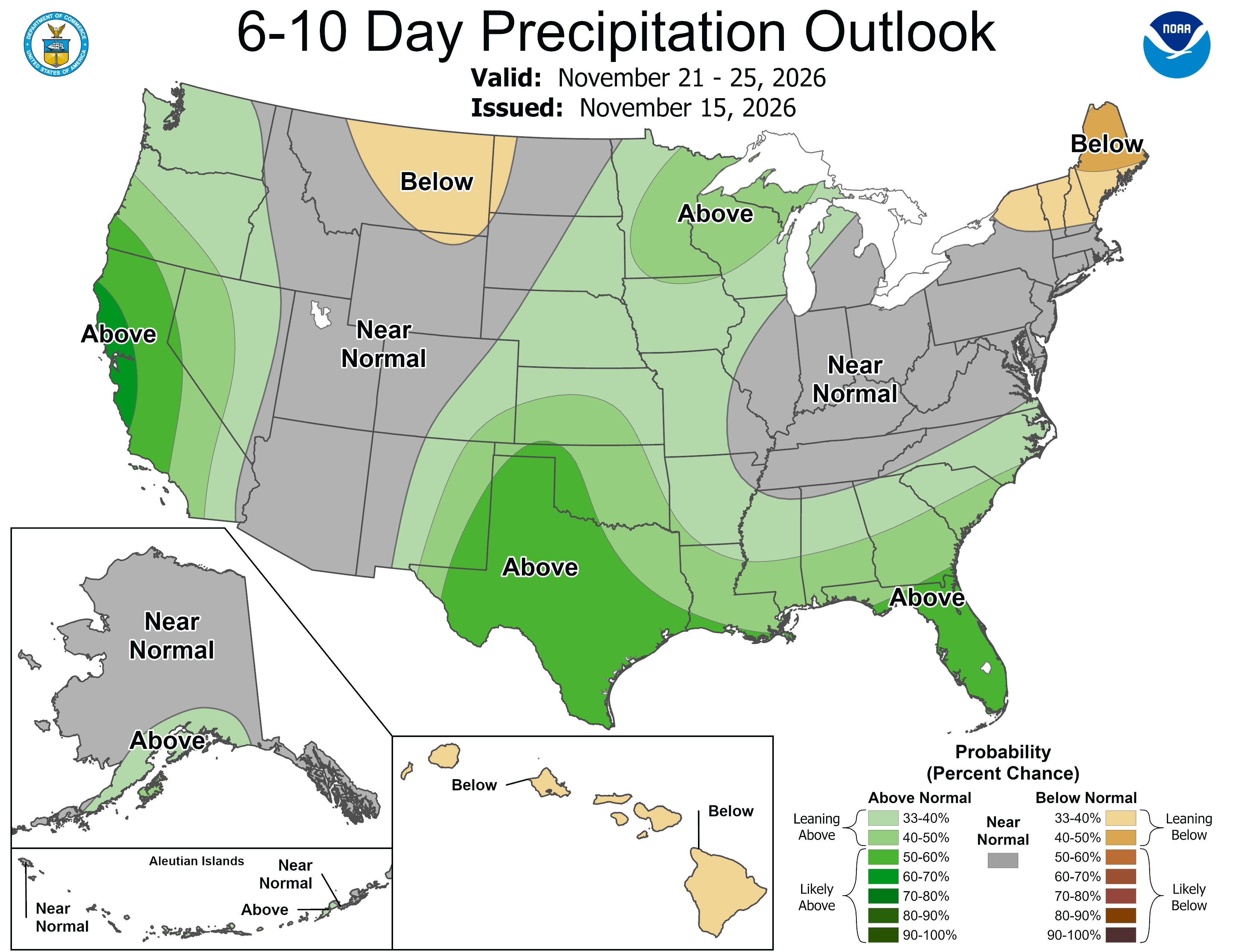
Confidence is low for days 6 through 10, Nov 21 to 25. The National Weather Service in Riverton says models disagree on the progression and strength of the next system, while NOAA's Climate Prediction Center favors near to above normal temperatures for the West and above normal precipitation along the West Coast and adjacent Great Basin.
 Tap to enlarge
 Tap to enlarge
Earlier updates
Sun, Nov 15Totals 2 in to 4 in
Wyoming: Modest snow Tuesday, rain first at Jackson base
- Totals about the same.
Snow above about 7,300 ft when it starts Tue afternoon, down to about 5,300 ft by Tue 10 pm. Heaviest Tue afternoon.
- Grand Targhee4 inat 9,839 ft4 inat 7,605 ft2 in to 4 inSchnee bis ins Tal
- Jackson Hole2 inat 10,397 ft1 inat 6,319 ft1 in to 3 inRain until about Tue 9 pm, then snow
Sat, Nov 14Totals 2 in to 3 in
Light snow for western Wyoming Tuesday
Snow above about 7,100 ft when it starts Tue afternoon, down to about 5,400 ft by Tue 7 pm. Heaviest Tue afternoon.
- Grand Targhee3 inat 9,839 ft3 inat 7,605 ft1 in to 3 inSchnee bis ins Tal
- Jackson Hole2 inat 10,397 ft1 inat 6,319 ft1 in to 2 inRain until about Tue 6 pm, then snow
Sources: model data from Open-Meteo (CC BY 4.0), with rain or snow worked out by status.live from the wet-bulb temperature at each resort's base and top lifts. Discussion: National Weather Service. Maps: NOAA WPC and CPC. Satellite: NOAA GOES-West via NASA GIBS. Lifts and chain controls: status.live, from the resorts and road agencies. Earlier storms.